


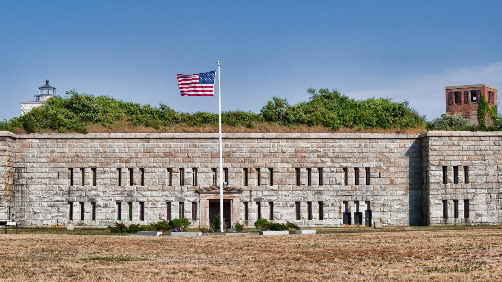

NEW BEDFORD The granite fort at the southern tip of Clark's Point in New Bedford was planned in the 1840s, built after 1857 and outdated before the masons finished. In 1905 an Army engineer asked to have it torn down. New Bedford objected, and the fort still stands.
A farm, then a fort
The federal government's first piece of the point was small. In 1800 Francis Allen sold about an acre at the tip to the United States for a lighthouse. The rest of the tip went to Joseph Howland, a New Bedford merchant, in 1803. His brother Cornelius, a whaleman who owned and commanded ships, bought it in 1819, and Cornelius's son Edward W. Howland, a merchant, inherited the farm in 1835.
On Sept. 23, 1857, Edward Howland sold the southernmost 60 acres, with the mansion house, barn and farmhouse, to Butler H. Bixby of New York City for $60,000. The next day Bixby sold the same land to the federal government for $78,000. Who Bixby was, and how he came to make that profit, is not clear from the record.
Planning had started years earlier. Maj. Richard Delafield wrote to the Army's chief engineer about a survey of Clark's Point in September 1846, and with the help of Capt. Robert E. Lee, then an Army engineer, he completed plans for the fort. The plan, submitted in 1848, showed its outline.
Two tiers instead of three
The land sale left out the roads, the first of several changes the Army made because New Bedford residents wanted the end of the point kept open to the public. Foundations were in by 1861. The plans called for three tiers of hand-cut granite, but by 1871 only two were done, and the third was dropped. The leftover blocks were later used by the city to build a seawall around the point.
By 1870 the design was already outdated, and the Army's Board of Engineers recommended that nothing more be done on it. Through all those years the fort had no formal name. Maps and letters called it the fort at Clark's Point.
Batteries, a protest and two wars
The city won temporary control of the grounds in 1892 for a recreation area, but the Army took the land back in 1898 for the Spanish-American War. Between 1898 and 1901 it built five gun batteries around the old fort, named Barton-Walcott 1 and 2, Gaston, Craig and Cross.
In April 1905 Lt. Col. J.H. Willard of the Corps of Engineers proposed removing the stone fort, writing that it had "no historical or sentimental associations." When word spread in 1906, New Bedford lawyer William W. Crapo wrote to Rep. William S. Greene of Fall River that the fort was "regarded by our shipping interests as a landmark of much importance in entering the harbor." An engineer's endorsement then called removal "not desirable at this time," citing Greene's protest.
During World War I the Army began Battery Milliken, a two-gun, 12-inch battery named for a New Bedford soldier killed in that war, and put up 23 buildings in less than a year for men headed overseas. The battery was finished in 1921. In World War II the Army built company blocks of barracks for troops mobilized in 1940 and 1941 and enclosed Milliken's guns in concrete casemates, finished in 1942. The guns came out shortly after the war.
Back to the city
Fort Rodman was declared surplus on June 5, 1947, and became a training center for Army and Navy reserves in 1949. Some buildings were used by the Job Corps in the 1960s. In 1973 New Bedford acquired all of Fort Rodman except a section that stayed an Army base, and the fort and its batteries, apart from Battery Milliken, were listed on the National Register of Historic Places as the Fort Taber District.
Label: Reported by us, from the town's posted records.
Notes
Every fact comes from the Historic American Buildings Survey report on the Fort Rodman Military Reservation, HABS No. MA-1256, kept by the Library of Congress, which cites deeds at the Bristol County registries and Army letters and plans at the National Archives. Quotes are from those letters as the report prints them. We read it on Oct. 27, 2026.
Corrections
No corrections to this story. If something here is wrong, tell us. Every correction is dated on the story and listed in our public log.
Sources (3)
- Library of Congress: Fort Rodman Military Reservation, Rodney French Boulevard, New Bedford (HABS MA-1256)Catalog record and significance statement, with links to the data and caption pages. Read Oct. 27, 2026.
- Historic American Buildings Survey, Fort Rodman Military Reservation, written historical and descriptive data (HABS No. MA-1256)National Park Service, Northeast Region. Pages 3 to 13: the 1800 lighthouse sale, the Howland farm, the 1857 sales, Delafield and Lee's plans, construction, the unbuilt third tier, the 1892 park and 1898 return, the Endicott batteries, the 1905 and 1906 correspondence, Battery Milliken, both world wars, the 1947 surplus declaration and the 1973 city purchase and National Register listing. Read Oct. 27, 2026.
- Wikimedia Commons: Fort TaberLead photo: the granite fort at Clark's Point, July 14, 2012, by Kenneth C. Zirkel, CC BY-SA 3.0. Read Oct. 27, 2026.